At a packed Paradise Coast Sports Complex, a 9-1-1 call comes in: a medical emergency somewhere in the bleachers. For most agencies, that’s a guessing game. But for Collier County’s Real-Time Operations Center (ROC), it’s pinpoint precision.
Using CommandCentral Aware integrated with Critical Response Group plans, analysts instantly see the caller’s location on a live map—complete with labeled sections, access points, cameras, fire extinguishers, and AEDs. The military-style grid means they can direct responders with clarity: “Proceed to Section Charlie-3, northeast stairwell.”
“It’s all about reducing response time,” said ROC Technical Manager Billy Gessner. “Even when a caller can’t give an exact location.”
4 Real-World Use Cases
1. Planned events
For large gatherings like the county fair, ROC analysts fly drones to create high-resolution aerial maps, overlay them with CRG grids, and import them into CommandCentral Aware.
The result: deputies, analysts and dispatchers share the same real-time picture—whether an incident is at the barn or the Ferris wheel.
Example: Collier County Fairgrounds map in CommandCentral Aware
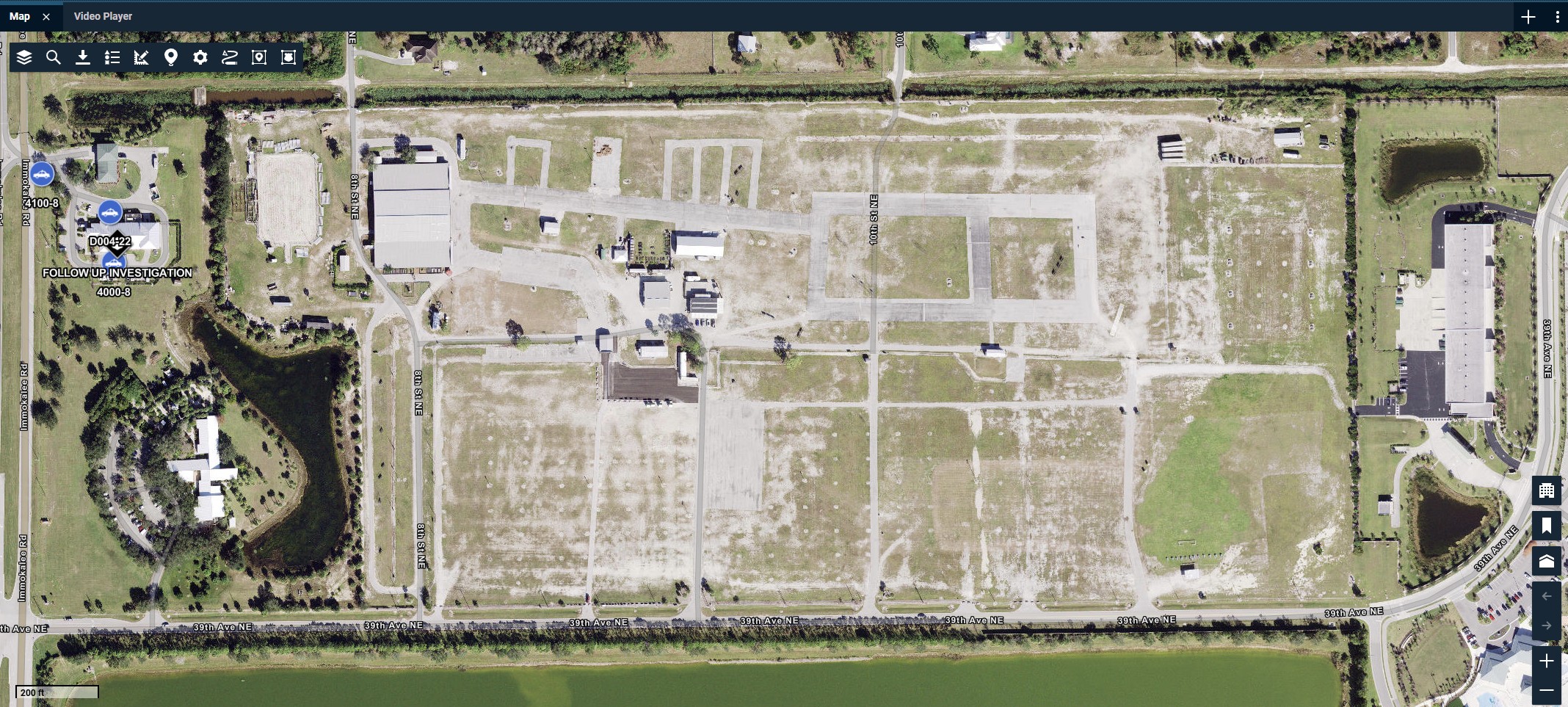
Collier County ROC CommandCentral Aware Map with only satellite basemap.
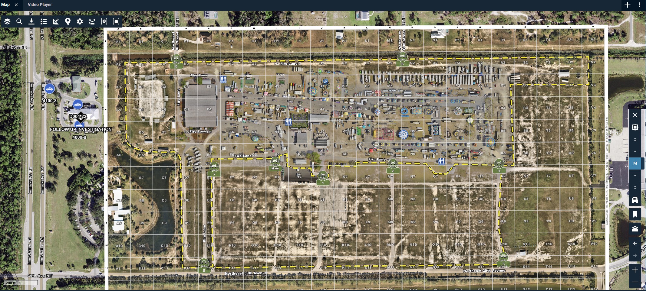
Collier County ROC CommandCentral Aware Map with CRG integration.
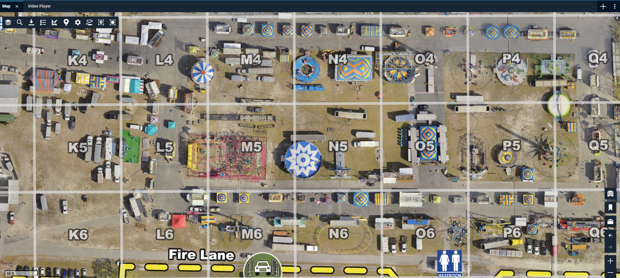
The CRG detailed guide map for the Collier County Fairgrounds that includes a military-style grid coordinate system, clearly marked entry and exit points, boundary perimeter, fire lanes, ride names, parking areas and additional public safety points of reference.
2. Unplanned, critical events
During active threats or emergencies, analysts use CommandCentral Aware’s tactical tools to mark “hot zones” and identify safe entry routes. Detailed CRG data lets them guide responders down to stairwell, camera, and AED locations—information that can save crucial seconds.
3. Navigating schools and complex facilities
With more than 65 schools county-wide, not every deputy knows every layout. Grid coordinates let the ROC direct them precisely: “Move to Bravo-2.” Even first-time responders instantly orient themselves.
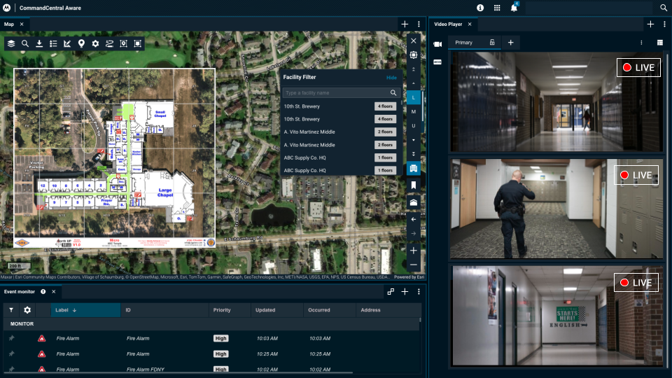
In CommandCentral Aware, an operator can view the CRG floor guide of a school alongside nearby camera resources available for greater situational awareness.
4. Search and accountability
For missing-person searches or natural disasters, analysts color-code searched areas and overlay responder history to prove coverage. “When families ask, we can show exactly where every team has been,” said Gessner.
A Unified Operating Picture
The ROC maintains over 500 maps—schools, hospitals, shelters, government buildings—layered inside CommandCentral Aware. Real-time radio and vehicle tracking, camera feeds, and drone detection appear directly over CRG floor plans, creating one shared view.
“It’s a single pane of glass,” Gessner said. “We can see responders, cameras, drones—everything—on one map.”
The takeaway: By merging CRG plans with CommandCentral Aware, the Collier County ROC transformed static blueprints into live intelligence—reducing confusion, accelerating response, and giving deputies peace of mind in every environment.

