The rise of Drone as First Responder (DFR)
The evolution of drones from niche military tools to essential law enforcement assets has reached a massive scale, with the Law Enforcement Drone Association (LEDA) reporting approximately 6,000 police drone programs nationwide. This fourfold increase since late 2024 is primarily driven by the shift toward Drone as First Responder (DFR) models. Unlike traditional reactive tools, DFR drones launch instantly from fixed rooftops upon a 9-1-1 call, frequently arriving on-scene minutes before ground units to provide high-definition livestreams and critical situational awareness to Real-Time Crime Centers.
Although the use of drones solutions for emergency response dates back over a decade, 2025 marked a definitive turning point for the industry, spurred by the “Unleashing American Drone Dominance” Executive Order. This landmark policy streamlined the regulatory process, leading to a surge in FAA waivers and the normalization of automated docking stations.
With daily drone use in public safety projected to triple over the next five years, according to the 2025 Verizon Frontline Public Safety Communications Survey, the DFR model has moved from an experimental concept to a tactical necessity. This article explores the tactical applications of DFR, the tangible advantages for first responders and the critical steps for launching a program at your department.
What is DFR? Understanding the system
Drones are unmanned aerial vehicles (UAV). In public safety, though, a Drone as a First Responder setup is a sophisticated ecosystem designed for reliability and speed.
While the FAA distinguishes between the aircraft itself and the entire system required for flight, a modern DFR program generally relies on five core pillars:
1) The aircraft (UAV)
First responder drones are typically small, multirotor aircraft chosen for their ability to hover and maneuver in tight urban environments. In 2026, the industry standard has moved toward NDAA-compliant platforms that offer:
- Rapid deployment: Going from dormant to airborne quickly.
- Redundant links: Multiple communication channels (often 5G-enabled) to ensure the livestream does not drop during a critical pursuit.
2) High-performance sensor payloads
However, drone responders are only as good as what they can see. Most DFR units carry a dual-sensor (EO/IR) payload:
- Electro-Optical (EO): High-resolution cameras that allow operators to read a license plate or identify a suspect’s description from hundreds of feet away.
- Infrared (IR): Thermal imaging that picks up heat signatures. This is essential for locating missing persons in wooded areas or tracking suspects hiding in the dark.
3) Automated docking stations
DFR is made possible by docking stations. These weather-proof hubs are installed on rooftops or at strategic locations throughout a precinct. They keep the drone charged, protected from the elements and ready to launch remotely via software.
Automated docking stations, in particular, remove the need for an officer at the launch site. This allows the remote pilot to operate from headquarters.
4) Tactical software and integration
Software is the nervous system of the DFR operation. It integrates the video feed directly into the department’s existing workflow.
- CAD integration: Drones can be set to launch automatically the moment a high-priority 9-1-1 call is entered into the computer-aided dispatch system.
- Real-time streaming: The feed is pushed to the mobile devices of officers on the ground. As they arrive, responders see exactly what the drone sees.
5) Sense and avoid technology
To fly safely Beyond Visual Line of Sight, DFR systems now incorporate advanced safety sensors. These include ADS-B receivers (to detect nearby manned aircraft) and AI-powered obstacle avoidance that enables the drone to navigate around obstacles autonomously.
How first responders use DFR
In traditional emergency response, the biggest hurdle is the information gap. The consequence is clear. Coordinating action when data is fragmented or missing often leads to inefficient resource allocation. DFR solves this challenge by providing an eye in the sky before the first responder arrives. In a modern configuration, the near-instant process goes from a deployment triggered when a 9-1-1 dispatcher receives a call to drone arrival and instant intelligence collection.
Tactical applications of drones for emergency response include:
- SAR: Traditional Search and Rescue is limited by terrain and the need for boots-on-the-ground visibility. DFR drones equipped with thermal imaging can blanket miles of impassable terrain in minutes. Nowadays, many systems use automated human detection (AHD) to flag heat signatures or out-of-place colors. This allows teams to locate missing hikers or children in total darkness or dense brush.
- Firefighting operations: Drones now serve as the scouts for fire crews. By arriving first, a DFR unit can identify the seat of the fire, assess roof integrity and spot hazardous materials before firefighters enter a structure. For brush fires, DFR relays a real-time map of the fire’s path. This helps protect lives and property.
- Active shooter and high-risk calls:In high-stakes situations, moving forward blind is the greatest risk to officer safety. DFR offers constant overwatch, tracking suspect movements behind fences, on rooftops or into confined areas. This allows SWAT teams to maintain time and distance, often leading to de-escalation rather than confrontation.
- Traffic accidents and call clearing: DFR allows supervisors to assess the severity of a collision instantly. If a drone confirms a minor fender-bender, the call can be cleared or handled by a community service officer. This keeps patrol units available for high-priority emergencies. Data from 2025 shows that DFR programs can reduce unnecessary patrol dispatches by as much as 15% to 20%.
- Emergency payload delivery: Where DFR 1.0 focused on video, the current generation uses specialized winch systems to deliver life-saving equipment within seconds of a crisis. Drones can send out overdose-reversal and allergy medication as well as automated external defibrillators (AEDs) to remote locations or traffic-congested areas. The impact of a faster response cannot be overstated; according to a 23-year study published in the Journal of the American Heart Association, early intervention by first responders with AEDs led to a 46.2% survival rate.
Benefits of drone use by first responders
In 2026, the baseline for public safety is shifting. The DFR model creates a permanent, on-call intelligence layer that arrives even before the first siren is heard. This transition from reactive to proactive response directly addresses three pillars of modern law enforcement: speed, safety and transparency:
Speed: Accelerated response and improved efficiency
A drone can be in the air within moments of a 9-1-1 call. DFR deployments have demonstrated that prepositioned drones can reach a scene in as little as 90 seconds, whereas municipal patrol units often target a seven-minute response time.
In many cases, the drone can gather enough information for dispatchers to establish that no emergency exists without sending ground units. This keeps patrol officers from diverting to non-emergency scenes. The Chula Vista Police Department, for example, has been able to remotely clear 25% of calls when it has launched drones.
Safety: Real-time tactical overwatch
When a call necessitates on-the-ground investigation, the drone assesses the situation and surroundings before field personnel arrive. This tactical overwatch establishes the situational awareness needed to protect both officers and the public. This level of dynamic assessment also contributes to de-escalation. By knowing ahead of time that a suspect is unarmed or in a state of crisis, officers can tailor their approach, leading to safer outcomes for all involved.
Transparency: Enhanced community trust
Modern DFR programs hold transparency as a core feature. By providing accessible flight logs and mission data, law enforcement can assure the community that drones are being used strictly for proactive safety and life-saving missions.
DFR in action: Real-world success stories
As recently as 2018, most agencies viewed unmanned systems through a narrow lens, primarily for specialized tasks like reconstruction or wide-area searches. Today, the maturation of autonomous flight and AI-driven intelligence has transformed DFR from a supporting actor into a core component of first-response toolkits and law enforcement technology solutions.
Public safety drones are now deeply embedded in the operational workflows of emergency response. The following examples highlight how this evolution is redefining the industry:
Chula Vista Police Department (California)
The CVPD operates the nation’s gold-standard DFR program. The department was the first in the U.S. to secure FAA BVLOS waivers. This allowed Chula Vista to respond to calls city-wide from central launch hubs.
For the mission, drones are deployed for all high-priority calls. The UAV delivers an overhead view for ground personnel, clears building interiors safely and documents crime scenes with high-resolution evidence.
The DFR program has cut response times by half. Four launch locations provide over 90% coverage of the city. Chief Roxana Kennedy identifies DFR as one of her most critical tools for de-escalating dangerous situations and protecting both officers and the community.
Redmond Police Department (Washington)
The Redmond PD has pushed the traditional DFR model into daily patrol operations. Redmond flies drones on nearly any call for service where aerial intel could assist.
UAVs can reach anywhere in the 14-square-mile community in 90 seconds or less. Crucially, all Redmond pilots are sworn officers. Chief Darrell Lowe emphasizes that this is essential for establishing probable cause. Only a sworn officer has the legal credibility to determine if a crime has occurred via the drone’s feed.
By 2025, the department’s full-time pilots were completing roughly 1,800 calls for service annually, with a public dashboard ensuring mission transparency.
Lakewood Police Department (Colorado)
Lakewood introduced its cutting-edge drone unit in 2025, meeting with immediate tactical success. In the first six months, drones arrived on scene ahead of ground units 80% of the time. They directly contributed to 131 arrests.
Beyond active calls, Lakewood also deploys drones for scheduled patrols in high-traffic areas to deter criminal activity and monitor critical infrastructure for security planning.
AED delivery for cardiac arrest
The use of drones for emergency medical delivery is another significant shift in the 2026 landscape. Recent studies have demonstrated the viability of the model for real-life out-of-hospital cardiac arrest (OHCA) cases:
- Swedish study results: In a four-month trial of 53 suspected OHCA cases, emergency response drones were eligible for dispatch in 14 instances. They successfully delivered an AED in 11 of 12 deployments.
- Time advantage: In 64% of these cases, the UAV arrived before the ambulance, providing a median time benefit of one minute and 52 seconds.
- Extended success: A second study showed that drones arrived before traditional EMS in 37 cases, with a median time gain of three minutes and 14 seconds. In the world of cardiac arrest, where every minute reduces the chance of survival by ten percent, these minutes are the difference between life and death.
Implementing a DFR program: Strategic considerations
DFR is surging. But most programs remain in a nascent stage. Their ongoing success requires a convergence of safety and security technology, law and community trust. So, as you move from concept to deployment, here are the key considerations for attaining stakeholder buy-in and securing a sustainable future:
Policy formulation and best practices
A robust policy manual is the foundation of any DFR initiative. While there is no single universal model, several best practices from organizations like IACP and Lexipol furnish a standardized framework. Your policy should explicitly address:
- Organizational structure: Clearly define where the DFR unit sits within the department (e.g., within the RTCC or Patrol) and identify the chain of command.
- Authorized versus unauthorized use: Differentiate between reactive, emergency drone response (authorized) and general, pervasive surveillance (prohibited). Policies must reflect federal laws and state-specific privacy statutes to ensure legal compliance.
- Department-wide training: Beyond remote pilots, the entire department should be familiar with the program’s goals. This ensures seamless integration between aerial and ground units.
Data management and retention standards
DFR programs generate unique and high-volume data. A comprehensive policy must set clear standards for how this digital evidence is handled:
- Unique data sets: DFR systems collect telemetry data, including flight logs, paths and altitudes. That information must be managed as official records.
- Retention periods: A 30-day rule is the common standard for non-evidentiary footage. If a recording has no evidentiary value, however, it should be purged to reduce storage costs and protect privacy.
- Annual reporting: Agencies should commit to an annual public report that summarizes the frequency of use, the types of calls handled and any updates to procedures.
Community-centric frameworks
In 2026, the strongest drone programs are rooted in community consensus. Therefore, designing guidelines alongside residents anchors technology adoption in a corresponding rise in public trust.
- Reactive vs. proactive support: Research consistently shows high public support for SAR and emergency drone deployments. It can be wise to tailor your mission to reflect these community expectations or to seek public acceptance for more proactive applications.
- Public-facing dashboards: Model your transparency effort on the CVPD’s. The Chula Vista dashboard displays real-time performance metrics, call types and response times.
- Regular policy reviews: Establish a schedule for community members to suggest revisions. This guarantees the program’s evolution alongside public sentiment.
Regulatory and legal landscape
Consult legal counsel regarding the evolving patchwork of laws and regulations:
- Warrant requirements: States like Florida and Virginia require search warrants for drone use unless exigent circumstances (like an active shooter or life-safety emergency) are present.
- Part 108: Monitor the finalization of FAA Part 108 (expected March 2026). This rule will move the industry away from case-by-case waivers toward a standardized national framework for BVLOS operations.
Funding and compliance
To maintain eligibility for federal grants, ensure your fleet is NDAA-compliant and meets the American Security Drone Act (ASDA) procurement standards, certifying that technology is free from foreign influence and cybersecurity vulnerabilities.
DFR technology considerations: Transition from tools to ecosystems
Over time, the industry has shifted away from pilot-on-the-roof deployments toward a fully integrated, automated operational ecosystem. When evaluating a 2026-ready DFR system, agencies should look beyond aircraft and focus instead on these four pillars of a scalable program:
Remote teleoperation and BVLOS capability
A true DFR system allows a remote pilot to guide the aircraft using a mouse and keyboard from a central command center or RTCC. To fly safely Beyond Visual Line of Sight, drones must use cellular links (LTE/5G) rather than standard radio frequencies. This ensures a persistent, high-definition connection even miles away from the launch site. Look for software that allows a remote pilot to hand off control to an officer on the scene if a tactical adjustment is needed locally.
AI-powered autonomy and safety
In our Part 108 world, the drone must be smart enough to protect itself. The DFR UAS should leverage AI-driven sensors to navigate around power lines, trees and buildings without pilot intervention.
Integrated incident review and livestreaming
Data is only valuable if it can be shared and reviewed. Your software should deliver universal streaming. That is the ability to push the drone’s live feed not just to the RTCC but to the mobile devices of every responding officer, as well.
A platform should also be able to sync drone footage with mapped alerts, officer movements and fixed city cameras. This complete lens is vital for post-incident investigation and training, and can further support a department’s existing incident response software and technology.
Cybersecurity and data integrity
A drone is as much an IT system as it is an aircraft. Ensure all video and telemetry data are stored in a secure, CJIS-compliant cloud. Encryption must be active both at rest and in transit to prevent remote interception.
Choose a vendor that supports a Flight History Webpage. This allows the community to see precisely where a drone flew and why. Providing a transparent view of dates, durations and call types is the fastest way to build public trust.
The Motorola Solutions DFR ecosystem
Rather than just standalone drones or best-in-breed software, Motorola Solutions delivers a unified DFR ecosystem that touches every point in the public safety workflow – from the 9-1-1 call to the drone flight through to video evidence.
Motorola Solutions CAPE Drone: Remote pilot platform
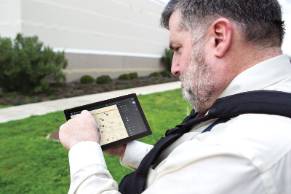
At the heart of the DFR offering is CAPE Drone software for video and flight control. CAPE allows a remote pilot to fly drones via a web browser from any location.
- Low latency: CAPE is optimized for 2026’s high-speed requirements, offering near-zero latency streaming. This way command staff sees the scene as it unfolds in real time
- Precision control: Remote pilots use a mouse-and-keyboard interface to navigate and zoom. This enables tactical support without the need for physical presence at the launch site.
- The CVPD Standard: As the pioneering DFR program, the Chula Vista Police Department uses CAPE software to maintain its 2.5-minute average response time, providing the aerial data needed to de-escalate encounters safely.
Instant tactical intelligence
Motorola Solutions integrates live 9-1-1 technology into the DFR workflow. This allows the remote pilot to hear emergency calls exactly as they come in, without waiting for a dispatcher to type up notes. This pre-dispatch awareness allows the pilot to launch the drone the moment a location is mentioned, often putting eyes on the scene before a ground unit is even assigned.
- AI-assisted triage: In 2026, the Assist AI Suite can automatically flag keywords like “gun” or “heart attack” in 9-1-1 audio, suggesting an immediate DFR launch to the pilot for faster life-saving intervention.
Integration with the RTCC
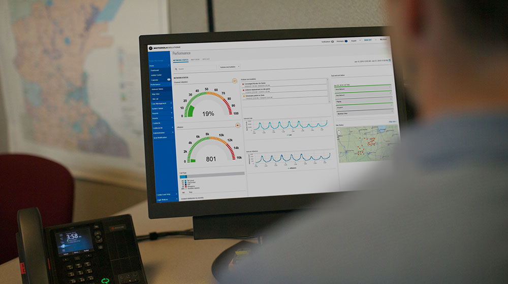
Motorola Solutions’ CommandCentral Aware serves as the operational hub. This situational awareness solution visualizes drone locations and livestreams alongside other critical resources on a single map.
- Data convergence: Drone video is layered with real-time feeds. As critical insights are uncovered, they can be shared instantly across the agency – directly from the software.
Secure evidence management
In 2026, data integrity is paramount. CAPE-equipped drones help to ensure that every flight results in an evidence-grade record. Content is automatically encrypted and stored in a secure cloud. This creates a tamper-proof audit trail, satisfying strict transparency and chain-of-custody requirements.
Purpose-built tactical response: The BRINC partnership
Through a strategic alliance with BRINC, Motorola Solutions has integrated BRINC Responder drones directly into the public safety workflow.
- Smart radio deployment: In a breakthrough for safety, an officer can now request aerial support directly to their GPS coordinates simply using their APX NEXT smart radio.
- Two-way audio: Unlike standard drones, BRINC units feature life-saving payloads and high-decibel speakers. This allows a remote pilot to talk to a suspect or give medical instructions to a bystander before ground units arrive.
Airspace security integration: Skysafe integration
Managing a UAV program also requires knowing who else is in the sky. The SkySafe integration into CommandCentral Aware grants total airspace domain awareness.
- Threat detection: SkySafe allows dispatchers to see the flight path, launch point and controller location of unauthorized drones in real time. This helps distinguish friendly agency UAVs and potential threats.
Conclusion: The future of first response is aerial
We are moving past the era where public safety drones were optional. As we look toward the full integration of FAA Part 108, the DFR model is becoming the baseline for the modern, data-driven agency.
Yet, building a successful DFR program requires an alignment of policy, community trust and integrated technology. From navigating the 2026 regulatory landscape to deploying the Motorola Solutions ecosystem, the road to aerial intelligence is complex. But the rewards, closing the information gap, improving response times and saving lives, are undeniable.